According to a recent report, 1 in 4 Californians lives in a ‘high risk’ wildfire area. After one of the deadliest and most destructive seasons in history, Orange County Fire Authority area officials have submitted approval for a new program aimed to improve wildfire support and minimize response time.
Watch the FIRIS pilot program in action:
The Fire Integrated Real-time Intelligence System (FIRIS) Pilot Program will last 150 days and will consist of enhanced intelligence, surveillance, and reconnaissance (ISR) technology. Since many ground-based commanders do not have the adequate resources to address early onset fires, the aerial resource capabilities of the FIRIS program can use the cutting-edge technology to benefit the Los Angeles, Riverside, San Diego, and Ventura counties.
Impact of the FIRIS Program
Many California fire department programs are understaffed and overworked during severe wildfire seasons. The interconnectivity of the FIRIS program can expand the resources available to underfunded programs to better support the needs created by fire-related incidents and disasters.
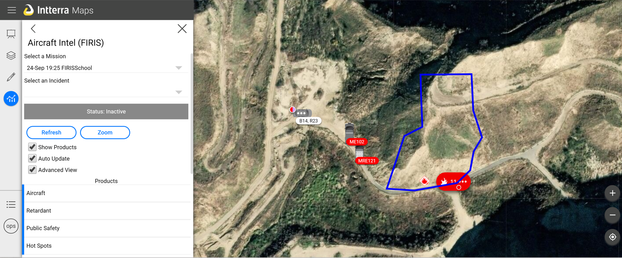
The program uses an aerial infra-red (IR) platform that integrates cutting-edge technologies provided by the Courtney Aviation aerial infra-red (IR) computerized mapping platform, the University of California, San Diego (UCSD) WIFIRE wildland fire spread technology, and Intterra wildfire decision support software into a single platform.
The goals of the program aim to:
- Provide intelligence information to better serve early response times
- Provide initial attack real-time fire perimeter mapping within 5 minutes of aircraft arrival
- Give agency policymakers “continuous” fire spread projection modeling that can be updated/refined based on newly collected data
- Define lessons learned which can be shared with the statewide fire community
The 150-day program will be evaluated based on a number of criteria including:
- Accuracy of fire area mapping
- Predictive effectiveness
- Communication efficiency
- Response time awareness
- Cost efficiency
Courtney Aviation will be providing multi-engine fixed-wing aircraft ten hours per day starting at 08:00 hours (with the ability to increase up to 14 hours). The specially outfitted aircraft will contain onboard technology that gathers and downlinks ISR intelligence info into the FIRIS platform. The UCSD WIFIRE technology will gather data to incorporate behavior predictions into the FIRIS system.
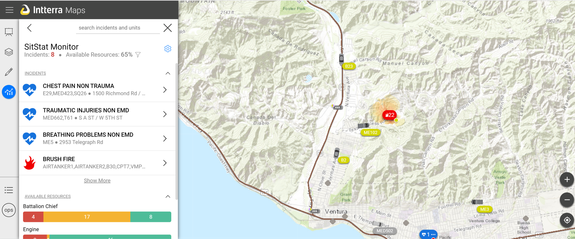
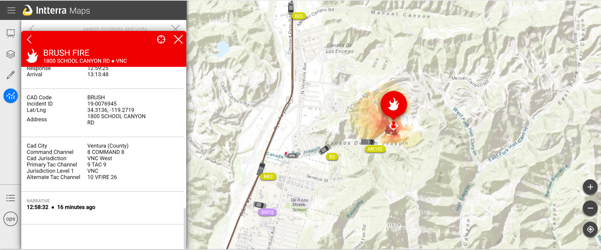
The software will be powered by Intterra, which will harness a single platform to view and manage multiple intelligence feeds provided by the Courtney Aviation aerial platform. Firefighters will then use the Intterra software to predict the likelihood of future fire outcomes, decrease response time, and improve overall firefighting efficiencies.
The sharing and exchanging of data amongst different State fire systems will improve communication and cohesion among different fire units. What’s more is the FIRIS program can be utilized at no cost during the 150-day project.
The Air Tactical Group Supervisor (ATGS)
The Air Tactical Group Supervisor (ATGS) will help service the FIRIS Pilot Program and will be responsible for managing incident airspace and coordinating fixed and rotary-wing aircraft operations.
The main duties of the unit will include:
- Supporting mission objectives by coordinating, assigning, and evaluating the use of aerial resources
- Communicating with ground personnel to help implement tactical and logistic objectives
- Reviewing current weather conditions and calculating fire risk probability
- Providing feedback on progress towards meeting intended objectives
- Working closely with dispatch to order, assign, and release aircraft in conjunction with the capabilities of fire management and incident personnel
State funding of $4,500,000 has been allocated to the pilot program, however, staff has begun increasing resources for the FIRIS program.
Future Implications of the Program
By providing decision makers with real-time information on fire conditions, the FIRIS tool will be able to help evacuate residents in a safe and controlled manner prior to reaching critical conditions.
The Firemap’s projections of wildfire behavior will also look at past and present weather conditions, forecasts, and vegetation levels to help predict fires before they happen.
The FIRIS program began on August 23, 2019, and may have widespread implications in terms of increasing awareness, predictability, and response time. If the program goes well, the state of California may be able to better disperse wildfire resources and limit the number of large-scale fire-related disasters.
How Intterra Can Help Minimize Wildfire Risk
Since 2010, Intterra has been providing fire agencies with crucial information and data to improve wildfire response. The cloud-based software allows users functionality to help improve operations, incident management, preplanning, and analytics and reporting to aide some of the busiest fire commands in the United States. The utilization of technology allows firefighters to better protect and service their communities at the highest level.